Lapsed, fee not paid29 drawings
Software & Apps · US 8,620,722 B2
System and method for organizing an enterprise
A system, method and program product are provided for organizing a store into a department store having shops associated therewith.
US 8,620,726 B2 · Assignee: CertusView Technologies, LLC · Inventors: Nielsen; Steven et al.
Sheet 1 of 12 from the published document. All sheets in the USPTO PDF
Methods, apparatus and systems including a computer comprising at least one hardware processor, at least one tangible storage medium (memory), and at least one input/output (I/O) interface for evaluating a quality of a locate and/or marking operation. First information relating to the marking operation (e.g., marking information) is compared to second information relating to the locate operation (e.g., locate information). In some examples, one or both of the marking information and the locate information may be filtered to improve data integrity in some manner. One or more indications of a quality assessment of the locate and/or marking operation is automatically generated based on such a comparison, and the one or more indications of the quality assessment are electronically stored on the at least one tangible storage medium, and/or electronically transmitted via the at least one I/O interface, so as to provide an electronic record of the quality assessment.
Field service operations may be any operation in which companies dispatch technicians and/or other staff to perform certain activities, for example, installations, services and/or repairs. Field service operations may exist in various industries, examples of which include, but are not limited to, network installations, utility installations, security systems, construction, medical equipment, heating, ventilating and air conditioning (HVAC) and the like. An example of a field service operation in the construction industry is a so-called "locate and marking operation," also commonly referred to more simply as a "locate operation" (or sometimes merely as "a locate"). In a typical locate operation, a locate technician visits a work site in which there is a plan to disturb the ground (e.g., excavate, dig one or more holes and/or trenches, bore, etc.) so as to determine a presence or an absenc
1 of 12 drawing sheets so far from the published document, cropped to the drawing. Every sheet is in the USPTO PDF.
What the patent claimed, word for word. All of it is now free to use.
Field service operations may be any operation in which companies dispatch technicians and/or other staff to perform certain activities, for example, installations, services and/or repairs. Field service operations may exist in various industries, examples of which include, but are not limited to, network installations, utility installations, security systems, construction, medical equipment, heating, ventilating and air conditioning (HVAC) and the like.
An example of a field service operation in the construction industry is a so-called "locate and marking operation," also commonly referred to more simply as a "locate operation" (or sometimes merely as "a locate"). In a typical locate operation, a locate technician visits a work site in which there is a plan to disturb the ground (e.g., excavate, dig one or more holes and/or trenches, bore, etc.) so as to determine a presence or an absence of one or more underground facilities (such as various types of utility cables and pipes) in a dig area to be excavated or disturbed at the work site. In some instances, a locate operation may be requested for a "design" project, in which there may be no immediate plan to excavate or otherwise disturb the ground, but nonetheless information about a presence or absence of one or more underground facilities at a work site may be valuable to inform a planning, permitting and/or engineering design phase of a future construction project.
In many states, an excavator who plans to disturb ground at a work site is required by law to notify any potentially affected underground facility owners prior to undertaking an excavation activity. Advanced notice of excavation activities may be provided by an excavator (or another party) by contacting a "one-call center." One-call centers typically are operated by a consortium of underground facility owners for the purposes of receiving excavation notices and in turn notifying facility owners and/or their agents of a plan to excavate. As part of an advanced notification, excavators typically provide to the one-call center various information relating to the planned activity, including a location (e.g., address) of the work site and a description of the dig area to be excavated or otherwise disturbed at the work site.
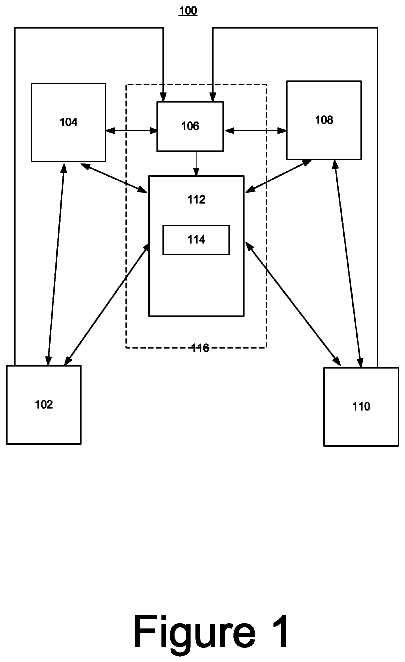
FIG. 1 illustrates an example in which a locate operation is initiated as a result of an excavator 110 providing an excavation notice to a one-call center 120. An excavation notice also is commonly referred to as a "locate request," and may be provided by the excavator to the one-call center via an electronic mail message, information entry via a website maintained by the one-call center, or a telephone conversation between the excavator and a human operator at the one-call center. The locate request may include an address or some other location-related information describing the geographic location of a work site at which the excavation is to be performed, as well as a description of the dig area (e.g., a text description), such as its location relative to certain landmarks and/or its approximate dimensions, within which there is a plan to disturb the ground at the work site. One-call centers similarly may receive locate requests for design projects (for which, as discussed above, there may be no immediate plan to excavate or otherwise disturb the ground).
Using the information provided in a locate request for planned excavation or design projects, the one-call center identifies certain underground facilities that may be present at the indicated work site. For this purpose, many one-call centers typically maintain a collection "polygon maps" which indicate, within a given geographic area over which the one-call center has jurisdiction, generally where underground facilities may be found relative to some geographic reference frame or coordinate system.
Polygon maps typically are provided to the one-call centers by underground facilities owners within the jurisdiction of the one call center ("members" of the one-call center). A one-call center first provides the facility owner/member with one or more maps (e.g., street or property maps) within the jurisdiction, on which are superimposed some type of grid or coordinate system employed by the one-call center as a geographic frame of reference. Using the maps provided by the one-call center, the respective facilities owners/members draw one or more polygons on each map to indicate an area within which their facilities generally are disposed underground (without indicating the facilities themselves). These polygons themselves do not precisely indicate geographic locations of respective underground facilities; rather, the area enclosed by a given polygon generally provides an over-inclusive indication of where a given facilities owner's underground facilities are disposed. Different facilities owners/members may draw polygons of different sizes around areas including their underground facilities, and in some instances such polygons can cover appreciably large geographic regions (e.g., an entire subdivision of a residential area), which may further obfuscate the actual/precise location of respective underground facilities.
Based on the polygon maps collected from the facilities owners/members, the one-call center may in some instances create composite polygon maps to show polygons of multiple different members on a single map. Whether using single member or composite polygon maps, the one-call center examines the address or location information provided in the locate request and identifies a significant buffer zone around an identified work site so as to make an over-inclusive identification of facilities owners/members that may have underground facilities present (e.g., to err on the side of caution). In particular, based on this generally over-inclusive buffer zone around the identified work site (and in some instances significantly over-inclusive buffer zone), the one-call center consults the polygon maps to identify which member polygons intersect with all or a portion of the buffer zone so as to notify these underground facility owners/members and/or their agents of the proposed excavation or design project. Again, it should be appreciated that the buffer zones around an indicated work site utilized by one-call centers for this purpose typically embrace a geographic area that includes but goes well beyond the actual work site, and in many cases the geographic area enclosed by a buffer zone is significantly larger than the actual dig area in which excavation or other similar activities are planned. Similarly, as noted above, the area enclosed by a given member polygon generally does not provide a precise indication of where one or more underground facilities may in fact be found.
In some instances, one-call centers may also or alternatively have access to various existing maps of underground facilities in their jurisdiction, referred to as "facilities maps." Facilities maps typically are maintained by facilities owners/members within the jurisdiction and show, for respective different utility types, where underground facilities purportedly may be found relative to some geographic reference frame or coordinate system (e.g., a grid, a street or property map, GPS latitude and longitude coordinates, etc.). Facilities maps generally provide somewhat more detail than polygon maps provided by facilities owners/members; however, in some instances the information contained in facilities maps may not be accurate and/or complete. For at least this reason, whether using polygon maps or facilities maps, as noted above the one-call center utilizes a significant buffer zone around an identified work site so as to make an over-inclusive identification of facilities owners/members that may have underground facilities present.
Once facilities implicated by the locate request are identified by a one-call center (e.g., via the polygon map/buffer zone process), the one-call center generates a "locate request ticket" (also known as a "locate ticket," or simply a "ticket"). The locate request ticket essentially constitutes an instruction to inspect a work site and typically identifies the work site of the proposed excavation or design and a description of the dig area, typically lists on the ticket all of the underground facilities that may be present at the work site (e.g., by providing a member code for the facility owner whose polygon falls within a given buffer zone), and may also include various other information relevant to the proposed excavation or design (e.g., the name of the excavation company, a name of a property owner or party contracting the excavation company to perform the excavation, etc.). The one-call center sends the ticket to one or more underground facility owners 140 and/or one or more locate service providers 130 (who may be acting as contracted agents of the facility owners) so that they can conduct a locate and marking operation to verify a presence or absence of the underground facilities in the dig area. For example, in some instances, a given underground facility owner 140 may operate its own fleet of locate technicians (e.g., locate technician 145), in which case the one-call center 120 may send the ticket to the underground facility owner 140. In other instances, a given facility owner may contract with a locate service provider to receive locate request tickets and perform a locate and/or marking operation in response to received tickets on their behalf.
Upon receiving the locate ticket, a locate service provider or a facility owner (hereafter referred to as a "ticket recipient") may dispatch a locate technician to the work site of planned excavation to determine a presence or absence of one or more underground facilities in the dig area to be excavated or otherwise disturbed. A typical first step for the locate technician includes utilizing an underground facility "locate device," which is an instrument or set of instruments (also referred to commonly as a "locate set") for detecting facilities that are concealed in some manner, such as cables and pipes that are located underground. The locate device is employed by the technician to verify the presence or absence of underground facilities indicated in the locate request ticket as potentially present in the dig area (e.g., via the facility owner member codes listed in the ticket). This process is often referred to as a "locate operation."
In one example of a locate operation, an underground facility locate device is used to detect electromagnetic fields that are generated by an applied signal provided along a length of a target facility to be identified. In this example, a locate device may include both a signal transmitter to provide the applied signal (e.g., which is coupled by the locate technician to a tracer wire disposed along a length of a facility), and a signal receiver which is generally a hand-held apparatus carried by the locate technician as the technician walks around the dig area to search for underground facilities. The transmitter is connected via a connection point to a target object (in this example, underground facility) located in the ground, and generates the applied signal coupled to the underground facility via the connection point (e.g., to a tracer wire along the facility), resulting in the generation of a magnetic field. The magnetic field in turn is detected by the locate receiver, which itself may include one or more detection antenna. The locate receiver indicates a presence of a facility when it detects electromagnetic fields arising from the applied signal. Conversely, the absence of a signal detected by the locate receiver generally indicates the absence of the target facility.
In yet another example, a locate device employed for a locate operation may include a single instrument, similar in some respects to a conventional metal detector. In particular, such an instrument may include an oscillator to generate an alternating current that passes through a coil, which in turn produces a first magnetic field. If a piece of electrically conductive metal is in close proximity to the coil (e.g., if an underground facility having a metal component is below/near the coil of the instrument), eddy currents are induced in the metal and the metal produces its own magnetic field, which in turn affects the first magnetic field. The instrument may include a second coil to measure changes to the first magnetic field, thereby facilitating detection of metallic objects.
In addition to the locate operation, the locate technician also generally performs a "marking operation," in which the technician marks the presence (and in some cases the absence) of a given underground facility in the dig area based on the various signals detected (or not detected) during the locate operation. For this purpose, the locate technician conventionally utilizes a "marking device" to dispense a marking material on, for example, the ground, pavement, or other surface along a detected underground facility. Marking material may be any material, substance, compound, and/or element, used or which may be used separately or in combination to mark, signify, and/or indicate. Examples of marking materials may include, but are not limited to, paint, chalk, dye, and/or iron. Marking devices, such as paint marking wands and/or paint marking wheels, provide a convenient method of dispensing marking materials onto surfaces, such as onto the surface of the ground or pavement.
In some environments, arrows, flags, darts, or other types of physical marks may be used to mark the presence or absence of an underground facility in a dig area, in addition to or as an alternative to a material applied to the ground (such as paint, chalk, dye, tape) along the path of a detected utility. The marks resulting from any of a wide variety of materials and/or objects used to indicate a presence or absence of underground facilities generally are referred to as "locate marks." Often, different color materials and/or physical objects may be used for locate marks, wherein different colors correspond to different utility types. For example, the American Public Works Association (APWA) has established a standardized color-coding system for utility identification for use by public agencies, utilities, contractors and various groups involved in ground excavation (e.g., red=electric power lines and cables; blue=potable water; orange=telecommunication lines; yellow=gas, oil, steam). In some cases, the technician also may provide one or more marks to indicate that no facility was found in the dig area (sometimes referred to as a "clear").
As mentioned above, the foregoing activity of identifying and marking a presence or absence of one or more underground facilities generally is referred to for completeness as a "locate and marking operation." However, in light of common parlance adopted in the construction industry, and/or for the sake of brevity, one or both of the respective locate and marking functions may be referred to in some instances simply as a "locate operation" or a "locate" (i.e., without making any specific reference to the marking function). Accordingly, it should be appreciated that any reference in the relevant arts to the task of a locate technician simply as a "locate operation" or a "locate" does not necessarily exclude or include the marking portion of the overall process. At the same time, in some contexts a locate operation is identified separately from a marking operation, wherein the former relates more specifically to detection-related activities and the latter relates more specifically to marking-related activities.
Inaccurate locating and/or marking of underground facilities can result in physical damage to the facilities, property damage, and/or personal injury during the excavation process that, in turn, can expose a facility owner or contractor to significant legal liability. When underground facilities are damaged and/or when property damage or personal injury results from damaging an underground facility during an excavation, the excavator may assert that the facility was not accurately located and/or marked by a locate technician, while the locate contractor who dispatched the technician may in turn assert that the facility was indeed properly located and marked. Proving whether the underground facility was properly located and marked can be difficult after the excavation (or after some damage, e.g., a gas explosion), because in many cases the physical locate marks (e.g., the marking material or other physical marks used to mark the facility on the surface of the dig area) will have been disturbed or destroyed during the excavation process (and/or damage resulting from excavation).
As discussed above, in various field service operations, a number of field technicians typically are dispatched to perform field operations at any given time, and over any given time period each technician may be assigned numerous work orders, or "tickets" specifying aspects of the field operations to be performed. The volume of tickets per technician may be particularly high in the construction industry, especially in connection with locate and marking operations. The inventors have recognized and appreciated that implementing and performing meaningful oversight and quality control activities in a timely fashion for several field technicians each performing several field operations in a given time period may present challenges, and that failure to perform meaningful oversight and quality control activities may adversely affect customer satisfaction.
Additionally, the inventors have appreciated that the time, effort, and cost that is associated with re-performing work in the field, or with correcting and/or improving poorly performed field calls, may be unacceptable. Consequently, the inventors have realized that a need exists for methods of providing oversight and quality control in field service operations in order to improve customer satisfaction, to identify and reduce the number of poorly performed tickets, and to improve visibility into distributed workforce operations.
In view of the foregoing, various inventive embodiments disclosed herein relate generally to methods, apparatus and systems for computer-aided determination of quality assessment for locate and/or marking operations. In some embodiments, a quality assessment decision may be solely under the discretion of a human reviewer, albeit facilitated in some respects by computer-aided display of information, and electronic record-keeping and communication functions associated with the quality assessment result(s). In other embodiments, information related to a locate and marking operation is electronically analyzed such that a quality assessment is not based solely on human discretion, but rather based at least in part on some predetermined criteria and/or metrics that facilitate an automated determination of quality assessment.
More specifically, in some embodiments, methods, apparatus and systems according to the present disclosure relate to at least partially automating oversight and quality assessment in underground facility locate and/or marking operations. For example, in some embodiments, an automated quality assessment system may receive information related to a locate and/or marking operation from one or more sources of electronic data (also referred to herein as "field information" or "field data"), analyze the contents of the received electronic data, and automatically assess the quality of the locate and/or marking operation based at least in part on the analysis. In other embodiments, automated analysis of at least some of the received electronic data relating to the locate and/or marking operation facilitates further analysis and/or quality assessment by a human, in which the quality assessment is not based solely on the discretion of the human, but is significantly informed in some manner by automated analysis of data.
In some exemplary implementations in which a quality of a locate and/or marking operation is assessed via an at least partially automated process, some or all of the available field information (e.g., which in some instances is derived from data contained in one or more electronic records of the locate and/or marking operation) is compared to "reference information" or "reference data" (which in some instances is derived from data contained in one or more "reference" electronic records). Examples of types of reference information/data used in a quality assessment process according to various embodiments discussed herein may include, but are not limited to: 1) information/data derived from or relating to one or more facilities maps that illustrate the presumed locations of underground facilities purportedly present in a geographic area proximate to or surrounding and subsuming the work site; 2) information/data derived from or relating to one or more previous locate and/or marking operations at or near the work site (referred to herein as "historical tickets" or "historical data"); 3) information/data relating to one or more environmental landmarks present in a geographic area proximate to or surrounding and subsuming the dig area (e.g., the work site and its environs), or within the dig area itself (referred to herein as "landmark information," which may be available, for example, from facilities maps, historical tickets, and/or field data collected at or around the time of the locate and/or marking operation being assessed); and/or 4) another type of field information (e.g., first field information may be compared with reference information in the form of second field information different from the first field information).
More specifically, in some embodiments, different types of field information may be compared to each other. For example, in some embodiments discussed in detail herein, first field information relating to a marking operation ("marking information") may be compared with reference information in the form of second field information relating to a locate operation ("locate information"). It should be appreciated that in embodiments in which different types of field information are compared with each other, the distinction between "field information" and "reference information" may not have any practical effect; however, for various reasons, in some implementations it may be desirable to designate one type of the field information as the "reference information" for purposes of comparison (e.g., it may be presumed a priori that a first type of field information is generally more reliable than a second type of field information, and that hence the first type of field information is taken as the "reference information" for purposes of comparative analysis).
In one aspect of embodiments in which marking information and locate information are compared with each other, the marking information and the locate information may pertain to the same work site/dig area and represent corresponding locate and marking operations both performed in response to the same locate request ticket (such that the marking information and locate information essentially are obtained concurrently). In another aspect, the marking information and the locate information may pertain to the same work site/dig area, but one of the marking information and the locate information may have been acquired in connection with performance of a different locate request ticket (e.g., one of the marking information and the locate information may be obtained from a "historical ticket"). With respect to one of the marking information and the locate information being obtained from a historical ticket, it should be appreciated that the same technician may or may not have been responsible for obtaining the respective marking information and locate information forming the basis of the comparative analysis.
In other aspects, the quality assessment of a locate and/or marking operation may be performed, in whole or in part, by one or more analysis components (e.g., one or more processors executing instructions) separate and/or remote from the locate and/or marking device used in connection with a locate and/or marking operation. Alternatively, the assessment may be performed, in whole or in part, by one or more analysis components incorporated within or otherwise coupled to a locate device, a marking device, and/or a combined locate and marking device. Depending on the nature of the assessment, it may be performed substantially in real time with respect to the generation of field information/data used in connection with the assessment (e.g., one or more of locate information, marking information and landmark information contained in electronic records of a locate and marking operation and/or an electronic manifest of same), otherwise during a locate and/or marking operation, or after completion of a locate and/or marking operation.
In some embodiments described herein, a notification may be generated based on the quality assessment performed. The notification may provide one or more indications of the quality of the locate and/or marking operation as a whole, or of some aspect thereof. For example, the notification may provide an indication of a degree of correspondence or discrepancy between different types of field data contained in one or more electronic records of the locate and/or marking operation (e.g., marking information compared with locate information), and/or between field data and reference data contained in one or more reference electronic records. Likewise, the notification may provide an indication that the locate and/or marking operation is or is not approved based on the comparison of different types of filed data, and/or the comparison of field data to selected reference data. The notification may be transmitted electronically or otherwise conveyed, for example, to one or more parties associated with one or more underground facilities within the dig area or in a geographic area proximate to or surrounding and subsuming the work site, one or more parties associated with the performance or oversight of the locate and/or marking operation, and/or one or more parties associated with excavation of the dig area, for example.
In some embodiments, a first electronic representation of first field information relating to a locate and/or marking operation (e.g., data in one or more electronic records, an electronic manifest, etc.), as well as a second electronic representation of either second field information or reference information (e.g., data in a reference electronic record from any of a variety of sources) to which the first electronic representation is compared, may be visually rendered (e.g., via a computer-generated visual representation in a display field) such that the electronic representations are overlaid to provide a visual aid to an automated assessment process. In some implementations, the visual aid may be viewed by a human to asses the quality of the locate and/or marking operation. In one exemplary implementation discussed in detail herein, a first electronic representation of first field information including marking information, and a second electronic representation of second field information including locate information, are visually rendered in a display field to facilitate comparative viewing of the marking information and the locate information.
In sum, one embodiment of the present invention is directed to a method, executed in a computer comprising at least one hardware processor, at least one tangible storage medium, and at least one input/output (I/O) interface, for evaluating a quality of a locate operation and/or a marking operation to identify a presence or an absence of at least one underground facility at a work site. The method comprises: A) comparing marking information relating to the marking operation to locate information relating to the locate operation; B) automatically generating, based on A), at least one indication of a quality assessment of the locate and/or marking operation; and C) electronically storing on the at least one tangible storage medium, and/or electronically transmitting via the at least one I/O interface, the at least one indication of the quality assessment so as to provide an electronic record of the quality assessment.
Another embodiment is directed to an apparatus for evaluating a quality of a locate and/or marking operation to identify a presence or an absence of at least one underground facility at a work site. The apparatus comprises: at least one input/output (I/O) interface; at least one memory storing processor-executable instructions; and a processor coupled to the memory and the at least one I/O interface, wherein upon execution of the processor-executable instructions by the processor, the processor: A) compares marking information relating to the marking operation to locate information relating to the locate operation; B) automatically generates, based on A), at least one indication of a quality assessment of the locate and/or marking operation; and C) controls the at least one memory so as to electronically store, and/or controls the at least one I/O interface so as to electronically transmit, the at least one indication of the quality assessment so as to provide an electronic record of the quality assessment.
Another embodiment is directed to at least one computer-readable storage medium encoded with instructions that, when executed by a processor in a computer comprising at least one input/output (I/O) interface, perform a method for evaluating a quality of a locate and/or marking operation to identify a presence or an absence of at least one underground facility within a work site. The method comprises: A) comparing marking information relating to the marking operation to locate information relating to the locate operation; B) automatically generating, based on A), at least one indication of a quality assessment of the locate and marking operation; and C) electronically storing on the at least one computer-readable storage medium, and/or electronically transmitting via the at least one I/O interface, the at least one indication of the quality assessment so as to provide an electronic record of the quality assessment.
Another embodiment is directed to an apparatus for automatically assessing a quality of a locate and/or marking operation. The apparatus comprises: a memory storing processor-executable instructions; at least one I/O interface; and a processor coupled to the memory and the at least one I/O interface, wherein upon execution of the processor-executable instructions, the processor: A) identifies at least one first geographic location at which at least one facility line of at least one underground facility was marked during the marking operation; B) obtains marking geo-location data based on A); C) identifies at least one first geographic location at which at least one facility line of at least one underground facility was detected during the locate operation; D) obtains locate geo-location data based C); E) determines a measure of distances between the marking geo-location data and the locate geo-location data; F) assesses the quality of the locate and/or marking operation based at least in part on E); and G) generates at least one indication of a quality assessment based on F).
Another embodiment is directed to a method, performed in a computer comprising at least one hardware processor, at least one tangible storage medium, and at least one input/output (I/O) interface, for assessing a locate operation and/or a marking operation to identify a presence or an absence of at least one underground facility at a work site. The method comprises: A) filtering at least one of marking information relating to the marking operation and locate information relating to the locate operation so as to provide filtered information; and B) comparing the marking information to the locate information, wherein at least one of the marking information and the locate information includes the filtered information.
Another embodiment is directed to an apparatus for assessing a locate and/or marking operation to identify a presence or an absence of at least one underground facility at a work site. The apparatus comprises: at least one input/output (I/O) interface; at least one memory storing processor-executable instructions; and a processor coupled to the memory and the at least one I/O interface. Upon execution of the processor-executable instructions by the processor, the processor: A) filters at least one of marking information relating to the marking operation and locate information relating to the locate operation so as to provide filtered information; and B) compares the marking information to the locate information, wherein at least one of the marking information and the locate information includes the filtered information.
Another embodiment is directed to at least one computer-readable storage medium encoded with instructions that, when executed by a processor in a computer comprising at least one input/output (I/O) interface, perform a method for assessing a locate and/or marking operation to identify a presence or an absence of at least one underground facility within a work site. The method comprises: A) filtering at least one of marking information relating to the marking operation and locate information relating to the locate operation so as to provide filtered information; and B) comparing the marking information to the locate information, wherein at least one of the marking information and the locate information includes the filtered information.
Another embodiment is directed to an apparatus for automatically assessing a quality of a locate and/or marking operation. The apparatus comprises: a memory storing processor-executable instructions; at least one I/O interface; and a processor coupled to the memory and the at least one I/O interface. Upon execution of the processor-executable instructions, the processor: A) identifies at least one first geographic location at which at least one facility line of at least one underground facility was marked during the marking operation; B) obtains marking geo-location data based on A); C) identifies at least one first geographic location at which at least one facility line of at least one underground facility was detected during the locate operation; D) obtains locate geo-location data based C); E) filters the locate geo-location data obtained in D); F) determines a measure of distances between the marking geo-location data and the filtered locate geo-location data; G) assesses the quality of the locate and/or marking operation based at least in part on F); and H) generates at least one indication of a quality assessment based on G).
For purposes of the present disclosure, the term "dig area" refers to a specified area of a work site within which there is a plan to disturb the ground (e.g., excavate, dig holes and/or trenches, bore, etc.), and beyond which there is no plan to excavate in the immediate surroundings. Thus, the metes and bounds of a dig area are intended to provide specificity as to where some disturbance to the ground is planned at a given work site. It should be appreciated that a given work site may include multiple dig areas.
The term "facility" refers to one or more lines, cables, fibers, conduits, transmitters, receivers, or other physical objects or structures capable of or used for carrying, transmitting, receiving, storing, and providing utilities, energy, data, substances, and/or services, and/or any combination thereof. The term "underground facility" means any facility beneath the surface of the ground. Examples of facilities include, but are not limited to, oil, gas, water, sewer, power, telephone, data transmission, cable television (TV), and/or internet services.
The term "locate device" refers to any apparatus and/or device, used alone or in combination with any other device, for detecting and/or inferring the presence or absence of any facility, including without limitation, any underground facility. In various examples, a locate device often includes both a locate transmitter and a locate receiver (which in some instances may also be referred to collectively as a "locate instrument set," or simply "locate set").
The term "marking device" refers to any apparatus, mechanism, or other device that employs a marking dispenser for causing a marking material and/or marking object to be dispensed, or any apparatus, mechanism, or other device for electronically indicating (e.g., logging in memory) a location, such as a location of an underground facility. Additionally, the term "marking dispenser" refers to any apparatus, mechanism, or other device for dispensing and/or otherwise using, separately or in combination, a marking material and/or a marking object. An example of a marking dispenser may include, but is not limited to, a pressurized can of marking paint. The term "marking material" means any material, substance, compound, and/or element, used or which may be used separately or in combination to mark, signify, and/or indicate. Examples of marking materials may include, but are not limited to, paint, chalk, dye, and/or iron. The term "marking object" means any object and/or objects used or which may be used separately or in combination to mark, signify, and/or indicate. Examples of marking objects may include, but are not limited to, a flag, a dart, and arrow, and/or an RFID marking ball. It is contemplated that marking material may include marking objects. It is further contemplated that the terms "marking materials" or "marking objects" may be used interchangeably in accordance with the present disclosure.
The term "locate mark" means any mark, sign, and/or object employed to indicate the presence or absence of any underground facility. Examples of locate marks may include, but are not limited to, marks made with marking materials, marking objects, global positioning or other information, and/or any other means. Locate marks may be represented in any form including, without limitation, physical, visible, electronic, and/or any combination thereof.
The description continues in the full USPTO document.
About 5,884 words. The USPTO PDF has it with every drawing.
Fees are due 3.5, 7.5 and 11.5 years after grant. This patent expired on December 31, 2025, so the fee marked "not paid" was the one that went unpaid.
METHODS AND APPARATUS FOR ANALYZING LOCATE AND MARKING OPERATIONS BY COMPARING LOCATE INFORMATION AND MARKING INFORMATION
Filed Aug 2010 · published Feb 2011Methods and apparatus for analyzing locate and marking operations by comparing locate information and marking information
Filed Aug 2010 · granted Dec 2013Earlier publications, parents and continuations. None of them can still be enforced, or this patent would not be listed.
Prior art cited by the examiner or applicant. Useful when you check your own idea for novelty.
Everything on this page comes from the documents linked above.