Technological field
An example embodiment relates generally to detecting and/or communicating information/data regarding features of a road network. An example embodiment relates generally to providing a correct, accurate, and up-to-date digital map representing a road network.
Background
Vehicles will soon be making driving decisions without human intervention. Map information/data is an important and indispensable source of guidance for autonomous vehicles, so it is preferable that the map information/data be correct, accurate, and up-to-date. The world is not static. It is constantly shifting and evolving. Therefore, it is preferred that mapping systems detect, verify, and update mapping information/data based on changes that are happening in the world in near real-time or real-time.
Brief summary of some example embodiments
Correct, accurate, and up-to-date map information/data is important for performing various navigation functions by an autonomous, self-driving vehicle, an advanced driver assistances system (ADAS), and/or a vehicle apparatus configured to assist and/or guide a human operator. For example, map information/data may be used to perform navigation functions such as localization, route determination, lane level route determination, lane maintenance, route guidance, lane level route guidance, provision of traffic information/data, provision of lane level traffic information/data and/or the like. However, as road networks and conditions of road networks (e.g., construction, obstructions, traffic incidents, state of traffic signals, and/or the like) are constantly shifting and evolving, it is preferred that the map information/data is regularly modified and/or updated to maintain map information/data that is correct, accurate, and up-to-date. Preferably the map information/data would be updated in at least near real time (e.g., near real time or real time) with respect to changes in the road network. One strategy for maintaining a digital map such that the map information/data of the digital map is correct, accurate, and up-to-date is to crowdsource information/data from sensors installed on vehicle in order to timely detect changes to the road network and/or conditions of the road network and to determine appropriate updates for the map information/data to reflect the detected changes.
Various embodiments provide methods, systems, apparatuses, and computer program products for updating a digital map representing a road network such that the map information/data of the digital map is correct, accurate, and up-to-date. For example, various embodiments provide methods, systems, apparatuses, and computer program products for crowdsourcing road information/data such that topology of portions of the road network and/or changes to the road network may be efficiently and timely identified and the map information/data of the digital map may be updated accordingly. In various embodiments, the road information/data is generated based on sensor information/data captured by sensors onboard a vehicle traversing at least a portion of the road network. A vehicle apparatus onboard the vehicle may process the sensor information/data to generate the road information/data. Various embodiments provide for the reporting of the road information/data in a predetermined, standardized data model using predetermined, standardized data formats. The predetermined, standardized data model and predetermined standardized data formats are configured for efficient use of network bandwidth for the transmitting of the road information/data. In various embodiments, the road information/data is packaged, compiled, formatted, and/or the like into a maplet. A maplet is a data structure comprising (a) abstracted, parameterized, fused representations of environment elements detected in sensor information/data captured by one or more sensors of a vehicle apparatus and (b) a representation of the vehicle's trajectory history for a segment of a vehicle's trajectory. In an example embodiment, the segment of the vehicle's trajectory may correspond to predetermined length and/or time of a single vehicle ignition cycle. In various embodiments, the data structure of the maplet is a predefined and/or predetermined, standardized data structure. In various embodiments, the environment elements comprise a topology of a segment of the road network as indicated by segment of the vehicle's trajectory and observations corresponding to the segment of the road network such as sign faces, road surface markings, pole-like objects, construction markers, traffic signals, lane markings, driving surface edge (e.g., edge of the pavement comprising the driving surface), road side barriers, and/or the like. For example, an environment element may be a real world object in the environment of the segment of the road network and/or a property (e.g., topology) of the road network itself.
In various embodiments, a network apparatus may generate and provide maplet requests based on a management strategy. For example, the network apparatus may determine that a request trigger has been identified corresponding to a particular region of a geographic area represented by the digital map. Responsive to determining that the request trigger has been identified, the network apparatus may generate and provide a request trigger such that vehicle apparatuses on board vehicles located in or near the region identified in the request (referred to as the request region herein) may receive the maplet request. Responsive to receiving a maplet request a vehicle apparatus may determine if the corresponding vehicle is located within the request region and/or if/when the corresponding vehicle enters the request region. When the vehicle is within the request region, the vehicle apparatus may use sensor information/data captured by sensors onboard the vehicle to generate an observation. The vehicle apparatus may then generate a maplet that encodes a trajectory of a corresponding vehicle and various classes of features within the observation. For example the maplet request may identify one or more classes for which road information/data should be provided if features corresponding to the identified one or more classes are identified within the observation. Some example classes include sign faces, road surface markings, pole-like objects, construction markers, traffic signals, lane markings, driving surface edge (e.g., edge of the pavement comprising the driving surface), and road side barriers. For example, the road information/data of the pose points and/or GNSS points classes may provide and/or encode a trajectory of the vehicle along a predetermined and/or predefined length of the request region. For example, the road information/data of the sign faces, road surface markings, pole-like objects, construction markers, traffic signals, lane markings, driving surface edge (e.g., edge of the pavement comprising the driving surface), and/or road side barriers classes may provide and/or encode road information/data regarding observations identified within the observation.
After generating the maplet, the vehicle apparatus may provide the maplet such that the network apparatus receives the maplet. In various embodiments, the maplet may be compressed (e.g., using a compression algorithm) and provided in a compressed format. The network apparatus receives the maplet, performs any necessary decompression, and analyzes the maplet. In various embodiments, the network apparatus may receive a plurality of maplets from a plurality of vehicle apparatuses that correspond to overlapping portions of the request region. The analysis of the received maplets performed may be based on the type of the request trigger that was identified. In various embodiments, the analysis of the received maplets may be used to update the digital map. For example, the analysis of the received maplets may be used to determine road network topology within the request region (e.g., to identify road segments, lane segments, and/or portions thereof that were not previously encoded in and/or represented by the digital map); determine whether map information/data corresponding to the request region is still accurate, correct, and up-to-date and/or whether the map information/data should be updated to better reflect the current real world conditions of the request region as encoded by the road information/data of the maplet; and/or to determine new and/or updated map information/data.
In an example embodiment, the digital map may be a high definition map that may be used for navigation functions for an autonomous, self-driving vehicle, an advanced driver assistances system (ADAS), and/or a human operator. For example, the digital map and/or portions thereof may be used to perform navigation functions such as localization, route determination, lane level route determination, lane maintenance, route guidance, lane level route guidance, provision of traffic information/data, provision of lane level traffic information/data and/or the like.
Various embodiments of the present invention provide technical solutions to the technical problems of providing a digital map that is correct, accurate, and up-to-date such that the digital map is an effective tool for performing navigation functions that enable navigation of a road network by an autonomous, self-driving vehicle, an advanced driver assistances system (ADAS), and/or a human operator. Various embodiments of the present invention provide technical solutions to the technical problem of transmitting sufficient and rich enough road information/data for maintaining and updating the digital map while not overwhelming the limited bandwidth network over which the road information/data is transmitted. Various embodiments of the present invention provide technical solutions to the technical problem of using sensor information/data captured by a plurality of vehicles having a variety of (possibly proprietary) sensor configurations onboard to build a coherent, self-consistent, and accurate representation of the road network (e.g., the digital map). In various embodiments, the maplets and corresponding methods, apparatuses, systems, and/or computer program products provide technical solutions to these technical problems by providing a maplet that provides road information/data in a predetermined/predefined, standardized data format using a predetermined/predefined, standardized data model and that is configured to be an efficient information/data packet so as to reduce the bandwidth needed to communicate the road information/data such that road information/data may be automatically, efficiently, and timely provided to the network apparatus for use in maintaining and updating the digital map.
In an example embodiment, a vehicle apparatus receives a maplet request identifying a request region. The vehicle apparatus (a) is onboard a vehicle, (b) comprises (i) a communication interface configured to communicate via at least one network, (ii) at least one processor, and (iii) at least one memory, and (c) is in communication with a plurality of sensors onboard the vehicle. Responsive to determining that the vehicle is within the request region, the vehicle apparatus processes sensor data captured by two or more sensors of the plurality of sensors to generate a multi-sensor data stream corresponding to a segment of a road network. The vehicle apparatus identifies one or more observations corresponding to at least one road marking within the multi-sensor data stream. The at least one road marking is a marking on a driving surface of the road network other than a lane marking. The vehicle apparatus generates a maplet based on the one or more observations and the maplet request. Generating the maplet comprises using a predetermined data model and a predetermined data format corresponding to a road marking observation class to encode road data corresponding to at least one of the one or more observations corresponding to that at least one road marking. The vehicle apparatus provides the maplet such that a network apparatus receives the maplet. The network apparatus is configured to validate or update map data of a digital map of the road network based at least in part on the maplet.
According to an aspect of the present invention, a method for providing a maplet corresponding to a road marking is provided. In an example embodiment, the method comprises receiving, by a vehicle apparatus, a maplet request identifying a request region. The vehicle apparatus (a) is onboard a vehicle, (b) comprises (i) a communication interface configured to communicate via at least one network, (ii) at least one processor, and (iii) at least one memory, and (c) is in communication with a plurality of sensors onboard the vehicle. The method further comprises, responsive to determining that the vehicle is within the request region, processing, by the vehicle apparatus, sensor data captured by two or more sensors of the plurality of sensors to generate a multi-sensor data stream corresponding to a segment of a road network. The method further comprises identifying, by the vehicle apparatus, one or more observations corresponding to at least one road marking within the multi-sensor data stream. The at least one road marking is a marking on a driving surface of the road network other than a lane marking. The method further comprises generating, by the vehicle apparatus, a maplet based on the one or more observations and the maplet request. Generating the maplet comprises using a predetermined data model and a predetermined data format corresponding to a road marking observation class to encode road data corresponding to at least one of the one or more observations corresponding to that at least one road marking. The method further comprises providing, by the vehicle apparatus, the maplet such that a network apparatus receives the maplet. The network apparatus is configured to validate or update map data of a digital map of the road network based at least in part on the maplet.
In an example embodiment, the maplet comprises a header comprising a road marking flag. In an example embodiment, the predetermined format comprises a field for a plurality of vertex points defining a two dimensional bounding polygon, each point of the plurality of vertex points provides coordinates of a point located at a vertex of the bounding polygon that bounds the road marking. In an example embodiment, the bounding polygon is a rectangle. In an example embodiment, the bounding polygon is a smallest possible polygon of a particular polygon class that bounds road marking. In an example embodiment, the predetermined format comprises a field for a covariance matrix for the plurality of vertex points. In an example embodiment, the predetermined format comprises a field for a type of the at least one road marking. In an example embodiment, the predetermined format comprises a field for a color of the at least one road marking.
According to another aspect of the present invention, an apparatus is provided. In an example embodiment, the apparatus comprises at least one processor, a communication interface configured to communicate via at least one network, and at least one memory storing computer program code. The apparatus is onboard a vehicle and is in communication with a plurality of sensors onboard the vehicle. The at least one memory and the computer program code are configured to, with the processor, cause the apparatus to at least receive a maplet request identifying a request region. The at least one memory and the computer program code are further configured to, with the processor, cause the apparatus to at least, responsive to determining that the vehicle is within the request region, process sensor data captured by two or more sensors of the plurality of sensors to generate a multi-sensor data stream corresponding to a segment of a road network. The at least one memory and the computer program code are further configured to, with the processor, cause the apparatus to at least identify one or more observations corresponding to at least one road marking within the multi-sensor data stream. The at least one road marking is a marking on a driving surface of the road network other than a lane marking. The at least one memory and the computer program code are further configured to, with the processor, cause the apparatus to at least generate a maplet based on the one or more observations and the maplet request. Generating the maplet comprises using a predetermined data model and a predetermined data format corresponding to a road marking observation class to encode road data corresponding to at least one of the one or more observations corresponding to that at least one road marking. The at least one memory and the computer program code are further configured to, with the processor, cause the apparatus to at least provide the maplet such that a network apparatus receives the maplet. The network apparatus is configured to validate or update map data of a digital map of the road network based at least in part on the maplet.
In an example embodiment, the maplet comprises a header comprising a road marking flag. In an example embodiment, the predetermined format comprises a field for a plurality of vertex points defining a two dimensional bounding polygon, each point of the plurality of vertex points provides coordinates of a point located at a vertex of the bounding polygon that bounds the road marking. In an example embodiment, the bounding polygon is a rectangle. In an example embodiment, the bounding polygon is a smallest possible polygon of a particular polygon class that bounds road marking. In an example embodiment, the predetermined format comprises a field for a covariance matrix for the plurality of vertex points. In an example embodiment, the predetermined format comprises a field for a type of the at least one road marking. In an example embodiment, the predetermined format comprises a field for a color of the at least one road marking.
According to yet another aspect of the present invention, a computer program product is provided. In an example embodiment, the computer program product comprising at least one non-transitory computer-readable storage medium having computer-readable program code portions stored therein. The computer-readable program code portions comprise executable portions configured, when executed by a processor of a vehicle apparatus onboard a vehicle, to cause the vehicle apparatus to receive a maplet request identifying a request region. The computer-readable program code portions further comprise executable portions configured, when executed by the processor of the vehicle apparatus, to, responsive to determining that the vehicle is within the request region, process sensor data captured by two or more sensors of the plurality of sensors to generate a multi-sensor data stream corresponding to a segment of a road network. The computer-readable program code portions further comprise executable portions configured, when executed by the processor of the vehicle apparatus identify one or more observations corresponding to at least one road marking within the multi-sensor data stream. The at least one road marking is a marking on a driving surface of the road network other than a lane marking. The computer-readable program code portions further comprise executable portions configured, when executed by the processor of the vehicle apparatus generate a maplet based on the one or more observations and the maplet request. Generating the maplet comprises using a predetermined data model and a predetermined data format corresponding to a road marking observation class to encode road data corresponding to at least one of the one or more observations corresponding to that at least one road marking. The computer-readable program code portions further comprise executable portions configured, when executed by the processor of the vehicle apparatus provide the maplet such that a network apparatus receives the maplet. The network apparatus is configured to validate or update map data of a digital map of the road network based at least in part on the maplet.
In an example embodiment, the maplet comprises a header comprising a road marking flag. In an example embodiment, the predetermined format comprises a field for a plurality of vertex points defining a two dimensional bounding polygon, each point of the plurality of vertex points provides coordinates of a point located at a vertex of the bounding polygon that bounds the road marking. In an example embodiment, the bounding polygon is a rectangle. In an example embodiment, the bounding polygon is a smallest possible polygon of a particular polygon class that bounds road marking. In an example embodiment, the predetermined format comprises a field for a covariance matrix for the plurality of vertex points. In an example embodiment, the predetermined format comprises a field for a type of the at least one road marking. In an example embodiment, the predetermined format comprises a field for a color of the at least one road marking.
According to still another aspect of the present invention, an apparatus is provided. In an example embodiment, the apparatus comprises means for receiving a maplet request identifying a request region. The apparatus comprises means for, responsive to determining that the vehicle is within the request region, processing sensor data captured by two or more sensors of the plurality of sensors to generate a multi-sensor data stream corresponding to a segment of a road network. The apparatus comprises means for identifying one or more observations corresponding to at least one road marking within the multi-sensor data stream. The at least one road marking is a marking on a driving surface of the road network other than a lane marking. The apparatus comprises means for generating a maplet based on the one or more observations and the maplet request. Generating the maplet comprises using a predetermined data model and a predetermined data format corresponding to a road marking observation class to encode road data corresponding to at least one of the one or more observations corresponding to that at least one road marking. The apparatus comprises providing the maplet such that a network apparatus receives the maplet. The network apparatus is configured to validate or update map data of a digital map of the road network based at least in part on the maplet.
Brief description of the drawings
Having thus described certain example embodiments in general terms, reference will hereinafter be made to the accompanying drawings, which are not necessarily drawn to scale, and wherein:
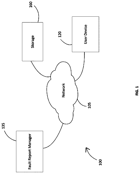
FIG. 1 is a block diagram showing an example architecture of an example embodiment of the present invention;
FIG. 1A is a block diagram showing another example architecture of an example embodiment of the present invention;
FIG. 2A is a block diagram of a network apparatus that may be specifically configured in accordance with an example embodiment;
FIG. 2B is a block diagram of a vehicle apparatus that may be specifically configured in accordance with an example embodiment;
FIG. 2C is a block diagram of an intermediary apparatus that may be specifically configured in accordance with an example embodiment;
FIG. 3 is a flowchart illustrating operations performed, such as by the network apparatus of FIG. 2A to maintain and/or update a digital map, in accordance with an example embodiment;
FIG. 4 is schematic diagram showing a portion of a road network, a request region, and a buffer region about the request region, in accordance with an example embodiment;
FIG. 5 is a flowchart illustrating operations performed, such as by the network apparatus of FIG. 2A to validate map information/data of a digital map, in accordance with an example embodiment;
FIG. 6 is a flowchart illustrating operations performed, such as by the network apparatus of FIG. 2A to expand a digital map, in accordance with an example embodiment;
FIG. 7 is a flowchart illustrating operations performed, such as by the network apparatus of FIG. 2A to update a digital map, in accordance with an example embodiment;
FIG. 8 is a flowchart illustrating operations performed, such as by the vehicle apparatus of FIG. 2B to provide maplets in response to a maplet request, in accordance with an example embodiment;
FIG. 9 is a flowchart illustrating operations performed, such as by the vehicle apparatus of FIG. 2B to generate and provide a maplet, in accordance with an example embodiment;
FIG. 10 illustrates an example of a maplet header, in accordance with an example embodiment;
FIG. 10A illustrates an example maplet, in accordance with an example embodiment;
FIG. 11A illustrates a trajectory of a vehicle along a portion of a road network;
FIG. 11B illustrates an example maplet portion comprising pose points that encode the trajectory of the vehicle shown in FIG. 11A , in accordance with an example embodiment;
FIG. 12A illustrates a trajectory of a vehicle along a portion of a road network;
FIG. 12B illustrates an example maplet portion comprising GNSS points that encode the trajectory of the vehicle shown in FIG. 12A , in accordance with an example embodiment;
FIGS. 13A and 13C illustrate a front view and a top view, respectfully, of a sign identified in an observation as the vehicle traversed the portion of the road network;
FIG. 13B illustrates an example maplet portion encoding road information/data representing the sign face shown in FIGS. 13A and 13C , in accordance with an example embodiment;
FIG. 14A illustrates a road marking identified in an observation as the vehicle traverse the portion of a road network;
FIG. 14B illustrates an example maplet portion encoding road information/data representing the road marking shown in FIG. 14A , in accordance with an example embodiment;
FIG. 15A illustrates a pole-like object identified in an observation as the vehicle traverse the portion of a road network;
FIG. 15B illustrates an example maplet portion encoding road information/data representing the pole-like object shown in FIG. 15A , in accordance with an example embodiment;
FIG. 16A illustrates a construction marker identified in an observation as the vehicle traverse the portion of a road network;
FIG. 16B illustrates an example maplet portion encoding road information/data representing the construction marker shown in FIG. 16A , in accordance with an example embodiment;
FIG. 17A illustrates a traffic signal identified in an observation as the vehicle traverse the portion of a road network;
FIG. 17B illustrates an example maplet portion encoding road information/data representing the traffic signal shown in FIG. 17A , in accordance with an example embodiment;
FIG. 18A illustrates a driving surface edge identified in an observation as the vehicle traverse the portion of a road network;
FIG. 18B illustrates an example maplet portion encoding road information/data representing the driving surface edge shown in FIG. 18A , in accordance with an example embodiment;
FIG. 19A illustrates a road side barrier identified in an observation as the vehicle traverse the portion of a road network;
FIG. 19B illustrates an example maplet portion encoding road information/data representing the road side barrier shown in FIG. 19A , in accordance with an example embodiment;
FIG. 20A illustrates a dashed lane marking and a solid lane marking identified in an observation as the vehicle traverse the portion of a road network; and
FIG. 20B illustrates an example maplet portion encoding road information/data representing the dashed lane marking shown in FIG. 20A , in accordance with an example embodiment.
Detailed description of some example embodiments
Some embodiments will now be described more fully hereinafter with reference to the accompanying drawings, in which some, but not all, embodiments of the invention are shown. Indeed, various embodiments of the invention may be embodied in many different forms and should not be construed as limited to the embodiments set forth herein; rather, these embodiments are provided so that this disclosure will satisfy applicable legal requirements. The term “or” (also denoted “/”) is used herein in both the alternative and conjunctive sense, unless otherwise indicated. The terms “illustrative” and “exemplary” are used to be examples with no indication of quality level. Like reference numerals refer to like elements throughout. As used herein, the terms “data,” “content,” “information,” and similar terms may be used interchangeably to refer to data capable of being transmitted, received and/or stored in accordance with embodiments of the present invention. As used herein, the terms “substantially” and “approximately” refer to values that are within manufacturing and/or engineering guidelines, allowances, and/or limits. Thus, use of any such terms should not be taken to limit the spirit and scope of embodiments of the present invention.
Additionally, as used herein, the term ‘circuitry’ refers to (a) hardware-only circuit implementations (e.g., implementations in analog circuitry and/or digital circuitry); (b) combinations of circuits and computer program product(s) comprising software and/or firmware instructions stored on one or more computer readable memories that work together to cause an apparatus to perform one or more functions described herein; and (c) circuits, such as, for example, a microprocessor(s) or a portion of a microprocessor(s), that require software or firmware for operation even if the software or firmware is not physically present. This definition of ‘circuitry’ applies to all uses of this term herein, including in any claims. As a further example, as used herein, the term ‘circuitry’ also includes an implementation comprising one or more processors and/or portion(s) thereof and accompanying software and/or firmware.
As used herein, the term “detection” denotes a simple atomic detection of a single real world object by a single sensor at a single instant in time. As used herein, the term “observation” denotes a single representation of a single real world object as it exists at the time the sensor information/data used to generate a corresponding maplet was captured, collected, and/or the like. An observation is formed and/or generated by fusing together two or more detections of the single real world object made by one sensor or a plurality of sensors over the course of the collection and/or capturing of the sensor information/data used to generate the corresponding maplet. As used herein, the term “feature” denotes an encoding of a single real world object that is part of and/or added to a digital map. A feature may be created by fusing together multiple observations of the single real world object provided by multiple maplets provided by multiple different vehicle apparatuses. I. General Overview
Methods, apparatus, systems, and computer program products are provided in accordance with an example embodiment for maintaining and/or updating a digital map. In various embodiments, the digital map is maintained and/or updated such that the map information/data is correct, accurate, and up-to-date. In an example embodiment, the map information/data is automatically updated in near real time or real time with respect to changes in the road network represented by the digital map. In various embodiments, the digital map is maintained and/or updated based on road information/data encoded in maplets. A maplet is a data structure comprising abstracted, parameterized, fused representations of one or more environment elements (e.g., real world objects and/or properties of the road network (e.g., topology)) detected in sensor information/data captured by one or more sensors of a vehicle apparatus and/or onboard a corresponding vehicle. For example, a maplet is a data structure that encodes observations created by fusing together detections corresponding to sensor information/data captured and/or collected as a vehicle traverses a portion of a road network (e.g., a segment of a vehicle trajectory). In an example embodiment, the data structure of the maplet further comprises a representation of the vehicle's trajectory history for a segment of a vehicle's trajectory. In an example embodiment, the segment of the vehicle's trajectory may correspond to predetermined length and/or time of a single vehicle ignition cycle. In various embodiments, the environment elements comprise a topology of a segment of the road network as indicated by segment of the vehicle's trajectory and observations corresponding to the segment of the road network such as sign faces, road surface markings, pole-like objects, construction markers, traffic signals, lane markings, driving surface edge (e.g., edge of the pavement comprising the driving surface), road side barriers, and/or the like. In various embodiments, the data structure of the maplet is a predefined and/or predetermined, standardized data structure. For example, the data structure of the maplet may be in accordance with a predetermined/predefined, standardized data model and have predetermined/predefined, standardized data formats for road information/data of each trajectory type or observation class.
In an example embodiment, a network apparatus is configured to automatically enforce and/or administrate a map management strategy. For example, the map management strategy may provide guidance and/or dictate how often a region of the road network is monitored for updates and/or changes, which observation classes of road information/data are requested from vehicle apparatuses for a particular maplet request, what trajectory type(s) to include in the maplet, and/or the like. Based on the map management strategy, the network apparatus may identify a request trigger corresponding to a request region. Responsive to determining that a request trigger has been identified, the network apparatus may generate and provide a corresponding maplet request such that plurality of vehicle apparatuses receive the maplet request. For example, the maplet request may be provided to vehicle apparatuses that are located within the request region; within a predetermined, predefined, and/or configurable distance from the request region; expected to enter the request region during a predetermined and/or predefined time window corresponding to the maplet request (e.g., based on travel history of the vehicle apparatus, a current route of the vehicle apparatus, and/or the like); and/or the like.
A vehicle apparatus may receive a maplet request and, responsive thereto, when the vehicle is located within the request region, the vehicle apparatus may generate and provide maplets based on the maplet request. For example, sensors onboard the vehicle may capture sensor information/data as the vehicle traverses a portion of the road network within the request region. For each predefined and/or predetermined length (e.g., 1 km, 5 km, and/or the like) and/or time (e.g., 30 seconds, 1 minute, 2 minutes, 3 minutes, and/or the like) of travel of the vehicle along the road network within the request region, a maplet may be generated. For example, the vehicle apparatus may fuse the sensor information/data captured by the sensors onboard the vehicle as the vehicle traversed the portion of the road network to form a uniform multi-sensor information/data stream of the environment surrounding the vehicle as the vehicle traversed the portion of the road network. For example, the detections corresponding to sensor information/data captured as the vehicle traversed the portion of the road network may be fused to form observations corresponding to the environment surrounding the vehicle as the vehicle traversed the portion of the road network. The road information/data of these observations may then be encoded and/or formatted into a maplet. The multi-sensor data stream may include a trajectory of the vehicle encoded as pose points and/or GNSS points. The multi-sensor data stream may include one or more observations such as sign faces, road surface markings, pole-like objects, construction markers, traffic signals, lane markings, driving surface edge (e.g., edge of the pavement comprising the driving surface), road side barriers, and/or the like. Each observation is associated with a corresponding observation class. Example observation classes include sign faces, road surface markings, pole-like objects, construction markers, traffic signals, lane markings, driving surface edge (e.g., edge of the pavement comprising the driving surface), road side barriers, and/or the like. The vehicle apparatus may generate a maplet encoding the trajectory of the vehicle as pose points and/or GNSS points. In various embodiments, the maplet may further encode road information/data corresponding to one or more observations and/or observations of one or more observation classes identified in the multi-sensor data stream. The vehicle apparatus may then provide the maplet (e.g., may transmit the maplet) such that the network apparatus receives the maplet. In an example embodiment, the vehicle apparatus may compress the maplet and the provided maplet may be the compressed maplet.
The network apparatus may receive a plurality of maplets in response to the provided maplet request. The network apparatus may analyze the plurality of maplets to maintain and/or update the digital map. For example, the network apparatus may analyze the plurality of maplets to identify road segments and/or lane segments of the road network not represented by the digital map. The identified road segments and/or lane segments that were not represented by the digital map may then be added to the digital map. In another example, the network apparatus may analyze the plurality of maplets to determine if the map information/data of the digital map is correct, accurate, and/or up-to-date. For example, the network apparatus may analyze the plurality of maplets to determine if the road information/data provided by the maplets is in agreement with the map information/data and/or to determine if the road information/data provided by the maplets indicates that there have been changes to the road network since the map information/data was last updated. In another example, the network apparatus may analyze the plurality of maplets to determine one or more updates to a digital map. After the digital map has been updated, the network apparatus may provide the updated digital map (and/or tiles thereof) such that a plurality of vehicle apparatuses receive the updated digital map (and/or tiles thereof) for use in performing one or more navigation functions. For example, the network apparatus may analyze the plurality of maplets to generate one or more features that may be compared to features of the digital map and/or that may be added to the digital map.
The description continues in the full USPTO document.
 Lapsed, fee not paid5 drawings